
Flinders through time.
2025 │ geolocated narrative.


project overview:
The breif:
The brief was to create a mobile app that served as a “Geolocated Narrative” covering 10 locations inside the CBD, all of which must be in a 25km radius of one another. There was a lot of freedom about the kind of narrative and locations we could choose. But it had to stick to a theme.
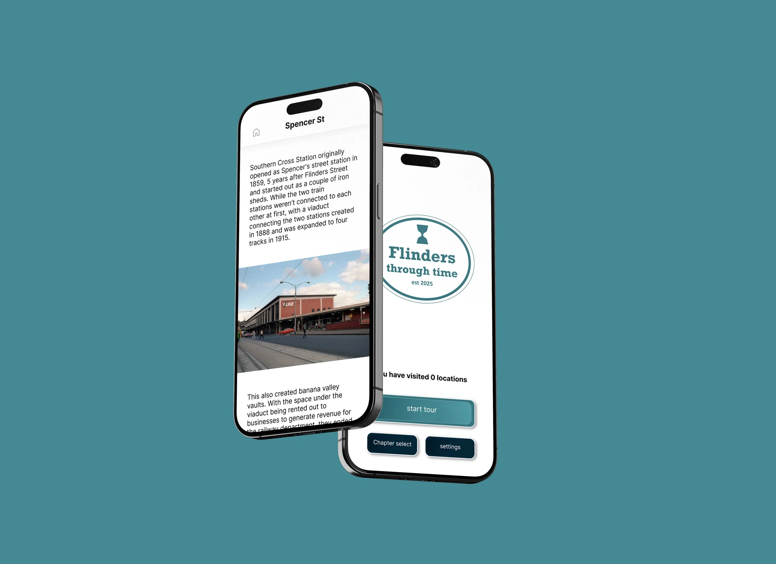
The idea was a geolocated history tour of the public transportation network around the CBD, focusing on the train stations, trams, and city loop. At each station you will learn more about the history of Melbourne's public transportation, play games and activities and earn a prize at the end when you complete all 10 locations. The app's name was “Flinders through time.”
The idea:
Some key concepts I had to understand before beginning the design process:
There is evidence that being in a physical location connected to a subject helps you learn more about it, as it’s more engaging for users and helps ideas stick, which is why I chose to use an educational app in the first place.
To keep users engaged with the app, I needed to add activities, rewards, or a strong narrative, or else they would stop using it halfway through.
The key design principles for mobile include clear navigation, simple menus, and text that is appropriately sized.
Understanding the context:
To understand what users wanted from this kind of app, I did a focus group with my target audience to see what they thought about the idea, and what they wanted to see potentially included in the app.
They ideally want the tour to take less than 2 hours, which can be a struggle when accounting for the time it takes to use public transportation.
Users wanted a good balance of humour and education.
Directions had to be clear and concise to help users navigate around the CBD.
Safety was a concern for users as well, due to being distracted by a phone around public transport.
Understanding the users:

There were some challenges I faced, mainly in terms of UI design,
Balancing the amount of written content in the app to still be appealing to look at, while still being educational.
Designing the map to be easy to navigate without having a screen full of overwhelming information.
Making the app easy to go through without a user accidentally losing their place in the narrative.
Challenges:
To fix these challenges, I came up with these solutions:
Having lots of images to tell the story, with humour and fun historical facts to make it educational and fun.
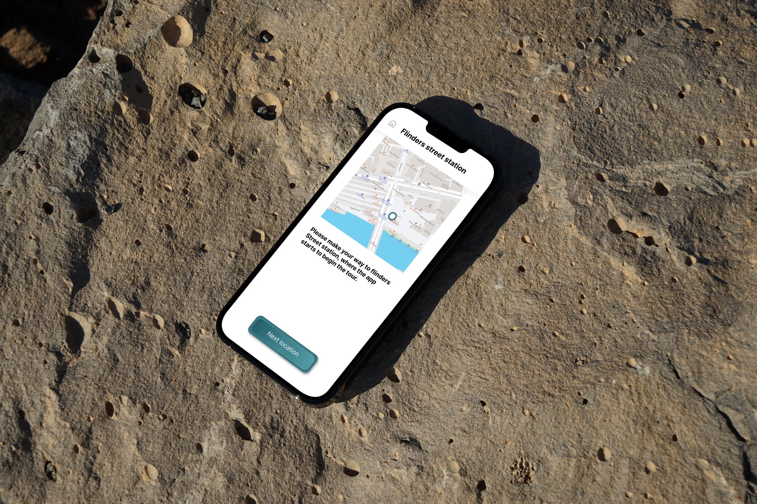
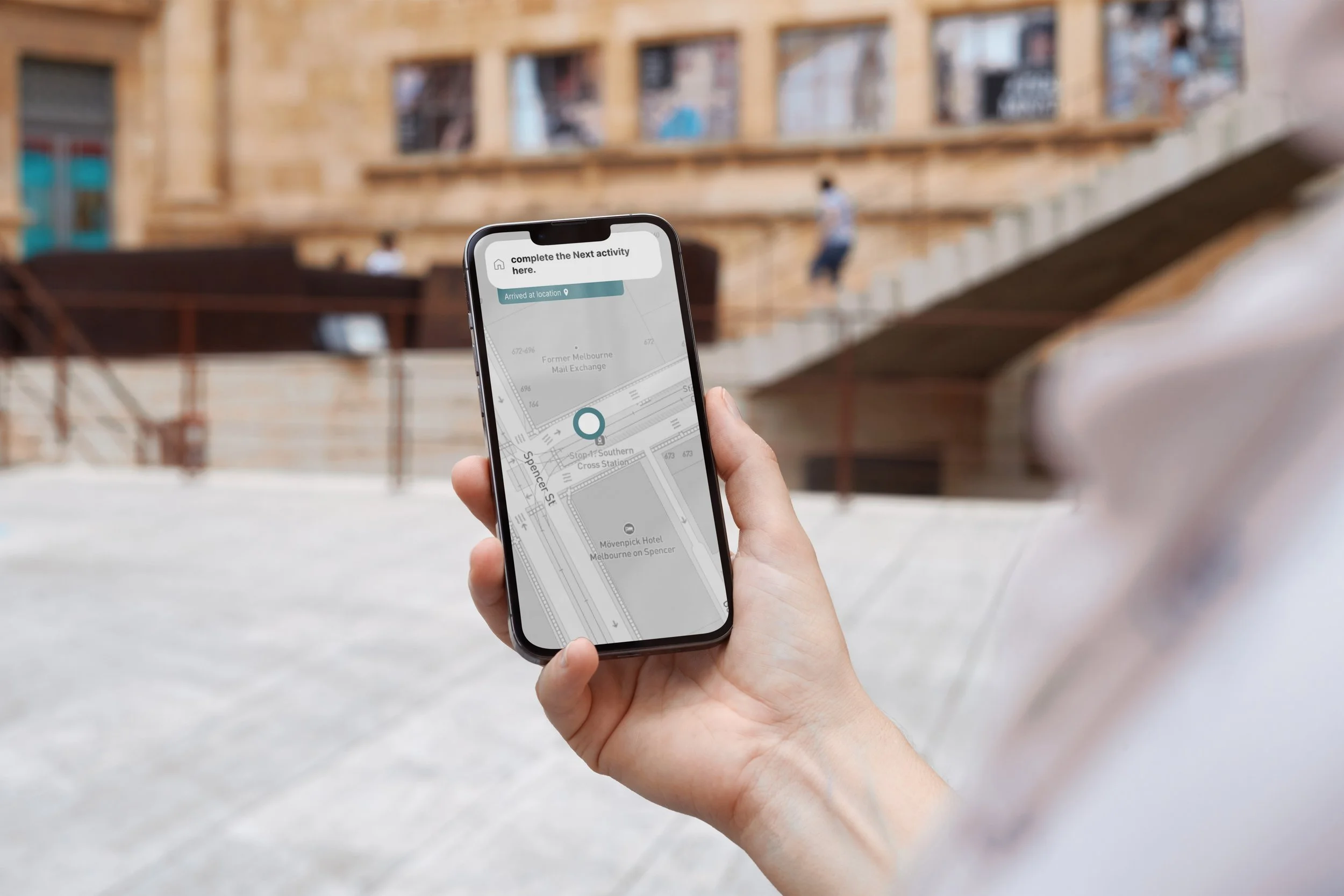
Using GPS and a line to help users navigate, with simple and easy to understand directions as well.
It has no menu, so the app guides users without them getting lost or skipping ahead by accident.
Solutions:
This was my first time doing both focus groups and field tests, and while they both proved to be incredibly useful in ways to understand users, they also require some practice to get good at. I found I didn’t ask enough questions to fully understand what my users wanted in terms of user interface design. This is a valuable learning experience for me and is something I will keep in mind as I continue to further my design skills.
Reflection: